
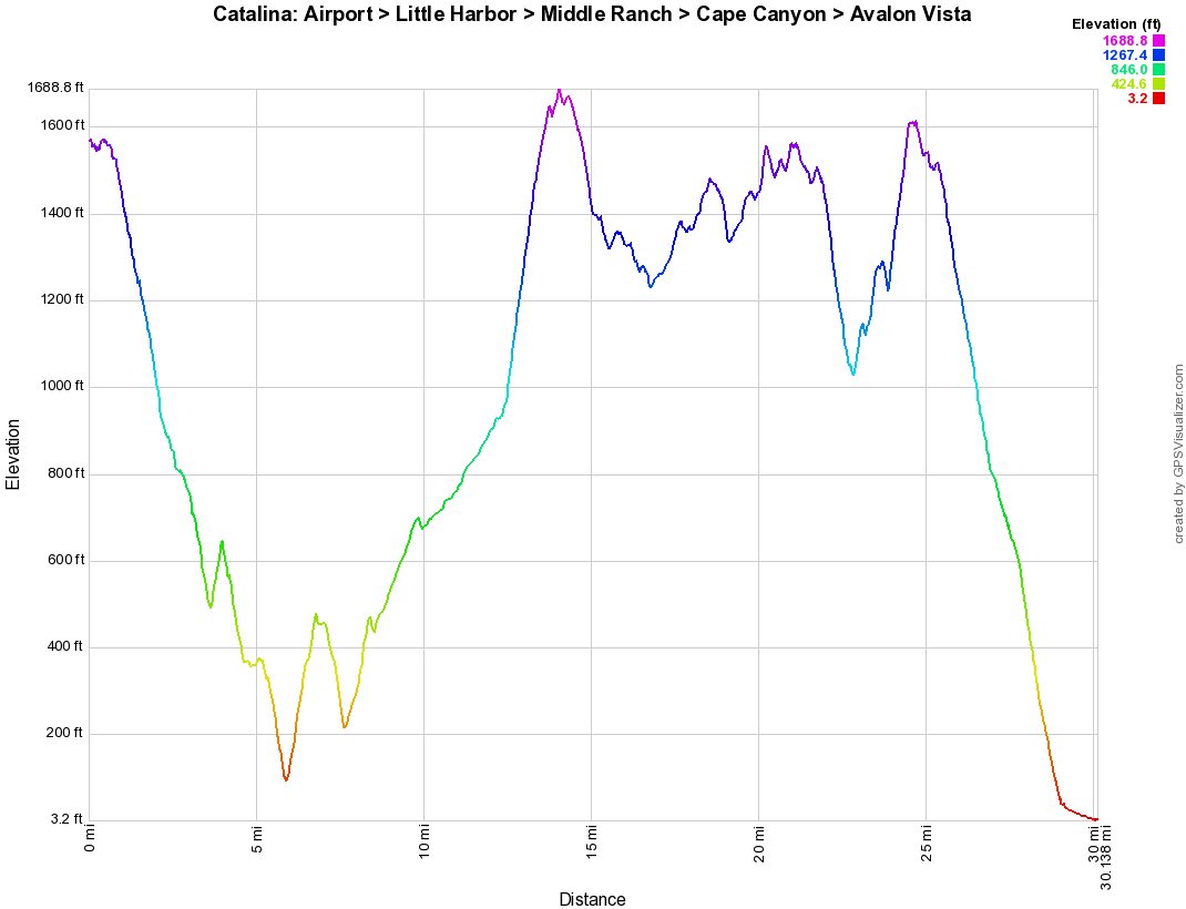
It’s not the longest route you can do on Catalina Island, but it’s up there. So you may be thinking why start at the airport? Well, because taking the shuttle up to that point saves A LOT of climbing and puts this ride in range of the Strong Intermediate that wants to try something more difficult than ever before, but totally possible to do in one day. Don’t worry, you’re still going to get 3,600 feet of climbing over 30 miles.
The best part of this ride is the beginning with a 5 mile downhill cruise to Little Harbor. Then the work begins as you regain that altitude drop for the next 10 miles passing through the heart of the island through its most narrow cooridor: Cape Canyon.
Once back at the road we drove in on, you get a break with some downhill action for a couple miles and then it’s 5 miles of rolling ridge lines and a quick downhill.
At this point in the ride (22 miles), you might be thinking that the worst is over but you ain’t seen nothing yet. The 2 mile “WALL” will suck every last bit of energy you have left out of you before you’re allowed to relax for the rest of the ride. The last 5 miles are pure downhill with awesome views. You’ll be pretty happy when Avalon finally comes into view six hours after your first joyride to the beach.
Ride Stats
| Distance (Miles) |
Min. Time (Hours) |
Max. Time (Hours) |
Ride Level |
|---|---|---|---|
| 30 | 6 | 8 | Strong Intermediate |
| % Singletrack | % Doubletrack | % Rideable | % Unpaved |
| 0 | 0 | 100 | 60 |
| Total Ascent (Feet) |
Starting Elevation (Feet) |
Max. Elevation (Feet) |
Best Season To Ride |
| 3671 | 1571 | 1663 | Any |